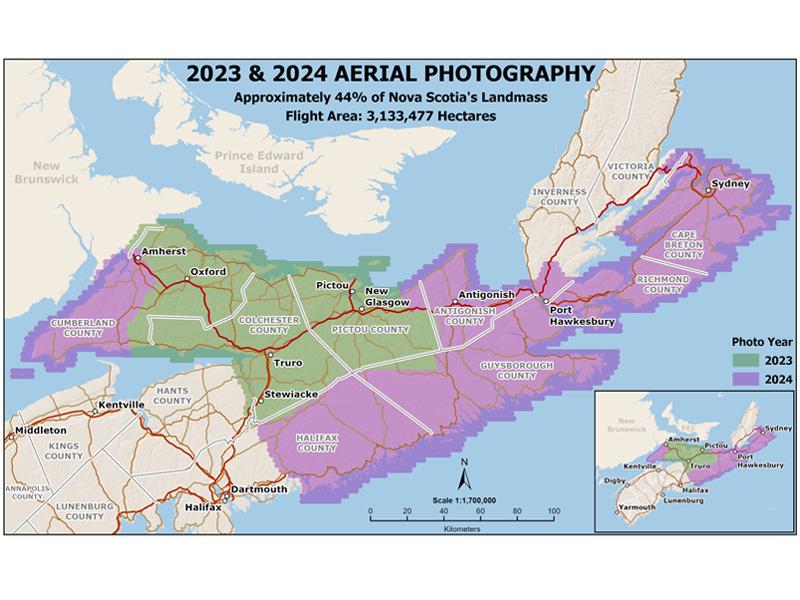
GeoNOVA is excited to share the release of new high-resolution aerial imagery captured in 2023 and 2024. Covering approximately 44% of Nova Scotia's land area, this update provides valuable geographic data for use in GIS, mapping, and planning across the province.
You can access the imagery through DataLocator: https://nsgi.novascotia.ca/datalocator/indexing
To purchase prints, please contact: [email protected]
