
Latest News

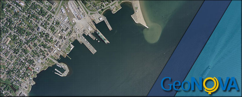
GeoNOVA is excited to share the release of new 2023 & 2024 orthophotography for the Cumberland, Colchester, and Pictou counties. A total of 306 map sheets are now available, including:
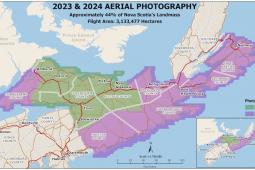
GeoNOVA is excited to share the release of new high-resolution aerial imagery captured in 2023 and 2024. Covering approximately 44% of Nova Scotia's land area, this update provides valuable geographic data for use in GIS, mapping, and planning
Browse our Mapping Products
We are working on a new online store for you. During the transition, you can still place orders for mapping products such as map books and atlases, aerial photography, and topographic maps. Please call 1-800-798-0706 (in Nova Scotia or PEI) or 1-902-667-7231 to place your order.
For a complete inventory of products and services available from Geographic Information Services, view our GIS Price List.
