Nova Scotia Atlas – Seventh Edition
The Nova Scotia Atlas contains rich, detailed maps of Nova Scotia identifying boundaries, lakes, rivers, roads, parks, beaches and more. This new edition includes the lake depths where known and even includes a Romer – allowing map enthusiasts to know the exact coordinates of map features on the pages. Updated and new protected areas, towers and windmills enhance the maps. Important for outdoor recreation and navigation, the Nova Scotia Atlas is invaluable for exploring Nova Scotia’s diversity and beauty.
Visit the Nova Scotia Geomatics Centre to purchase, inquire at your favourite bookstore or e-mail [email protected] for more information.
Nova Scotia Topographic Mapping
The Nova Scotia Geomatics Centre also has 1:10,000 scale maps available for the Province of Nova Scotia.
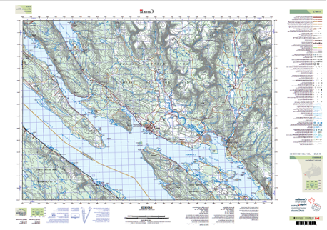
These 1:10,000 scale maps are a closer view of the mapped area with each map showing approximately 4 miles from left to right.
The contour lines of these 1:10,000 scale maps are set to represent a change in elevation of 5 meters.
These maps can be downloaded for free from the NS Data Locator Indexing System.
The overall dimension of the printed map is approximately 44 x 30 inches.
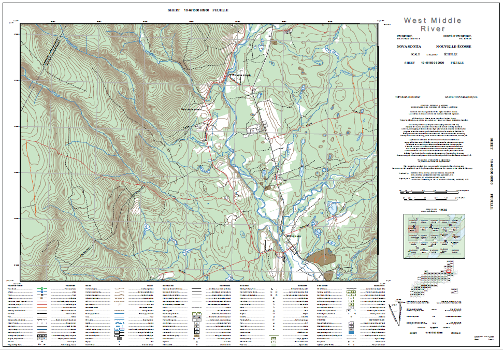
Paper copies of these 1:10,000 scale maps can be purchased from our customer service desk in Amherst at the Nova Scotia Geomatics Centre for a cost of $ 10.97 plus tax. The purchase can also be made by emailing our team at [email protected]
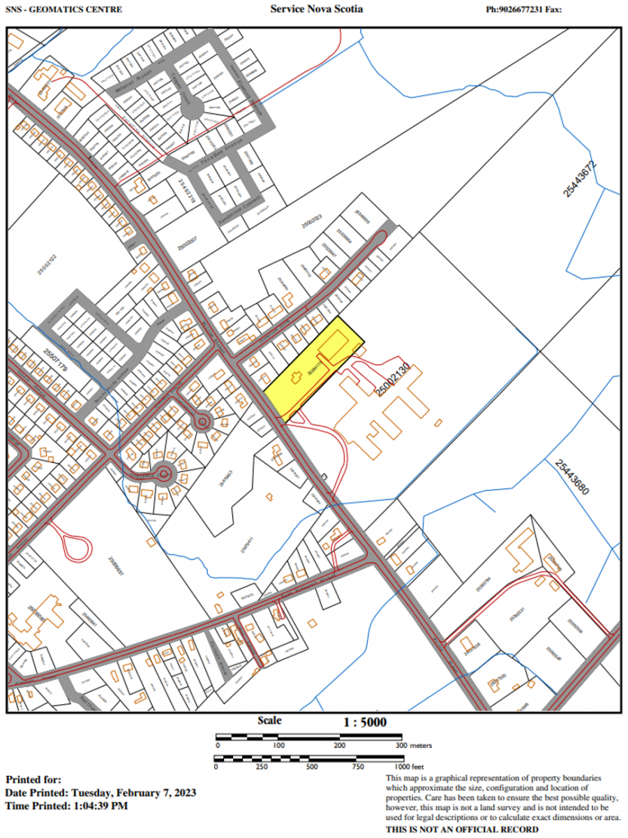
Nova Scotia Property Mapping
We provide property maps in digital or hardcopy format which are as a graphical representation of property boundaries. Property Maps can be provided as PDF files or in hardcopy color prints at 8.5 x 11, 11 x 17, or 36 x 24 page size. Price varies by page size.
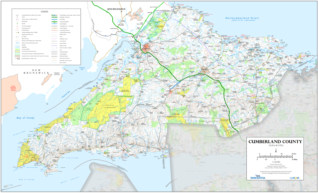
Nova Scotia County Mapping
1:150,000 county maps are available showing entire counties in Nova Scotia. Clients can choose to include contour lines and these printed maps cost $17.51 plus tax and shipping.
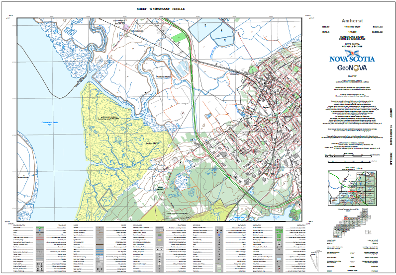
National Topographic System (NTS) Mapping
1:50,000 scale topographic maps are part of the NTS collection and cover all of Canada.
These maps show approximately 20 miles left to right. The contour lines of these maps are set to indicate a change of 25 meters. The overall dimension of these maps is approximately 37 x 26 inches.
Each of these 1:50,000 scale maps are available free of charge as a free download from the ‘Geogratis’ website as part the Department of Natural Resources Canada. The following Geogratis Instructions document may help you in using the Geogratis site.
The NTS also has the 1:250,000 scale maps available for any place in Canada and these are free to download from their website.
The maps can also be purchased as paper copies from the NS Geomatics Centre for a cost of $ 11.45 each , plus tax.
NTS Indexes can be viewed as PDFs at : Index of /pub/nrcan_rncan/vector/index/index_pdf (canada.ca)
Purchasing printed copies of the NTS maps can be done by emailing our team at [email protected]
Historical Mapping
There are a few options where you might find historical maps of Nova Scotia.
Nova Scotia Archives houses a map collection of Historical Maps of Nova Scotia. Their collection includes digital materials from the 1700s, 1800s and 1900s.
You may also wish to visit the Historical Land Information site of the Department of Natural Resources which includes records and maps tracking Crown Land transactions.
Geological Mapping
For Geological Maps, the Department of Natural Resources and Renewables website for Mineral Resources Branch has a variety of maps in their map gallery which can be downloaded at https://novascotia.ca/natr/meb/geoscience-online/maps.asp
